Difference between revisions of "Project/2021-NPS-1-Mail"
From C3LearningLabs
(→Method) |
|||
| Line 172: | Line 172: | ||
|[[File:c3fire-pic-number-gray-15.gif|Drone]] | |[[File:c3fire-pic-number-gray-15.gif|Drone]] | ||
|Drone / UAV | |Drone / UAV | ||
| + | |} | ||
| + | |||
| + | |||
| + | === Maps === | ||
| + | The experiment did use four maps. | ||
| + | |||
| + | {| | ||
| + | |[[File:2017-SweCanTeam-1-Map-1.png|200px|none|IMap 1]] | ||
| + | | | ||
| + | |[[File:2017-SweCanTeam-1-Map-2-RL.png|200px|none|Map 2]] | ||
| + | | | ||
| + | |[[File:2017-SweCanTeam-1-Map-3-FVRR.png|200px|none|Map 3]] | ||
| + | | | ||
| + | |[[File:2017-SweCanTeam-1-Map-4-RR.png|200px|none|Map 4]] | ||
| + | |- | ||
| + | |style="text-align: center;" | | ||
| + | Map 1<br> | ||
| + | Orginal<br> | ||
| + | CanSwe1-C1-F80.con | ||
| + | | | ||
| + | |style="text-align: center;" | | ||
| + | Map 2<br> | ||
| + | Rotate Left<br> | ||
| + | CanSwe1-C2-F60.con | ||
| + | | | ||
| + | |style="text-align: center;" | | ||
| + | Map 3<br> | ||
| + | Flip Vertical<br> | ||
| + | Rotate Right<br> | ||
| + | CanSwe1-C3-F100.con | ||
| + | | | ||
| + | |style="text-align: center;" | | ||
| + | Map 4<br> | ||
| + | Rotate Right<br> | ||
| + | Not Used | ||
|} | |} | ||
Revision as of 20:39, 12 August 2021
Project
| Year | 2021 |
| Project Name | |
| Project | |
| Acronym | 2021-NPS-1 |
| Organisation | RISE SICS East, Linköping University, Laval University, Saab |
| Country | USA |
| Contact Person | |
| Project Members |
System modules
|
|
|
| ||||||||||||||||||||||||||||||||||||||
Objects
The scenario contain the following map objects.
| Fire Spread Delay |
|||
| Normal | 1 | Normal | |
| Birch | 2 | Slow | |
| Pine | 0.5 | Fast | |
| Fuel | |||
| Water | |||
| House | |||
| Tent | |||
| People | |||
| Medical Transit Point |

|
Big landing area |
Units
| Fire Fighting Units | |
| Logistic Units | |
| Search and Rescue Units | |
| Drone / UAV |
Maps
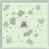
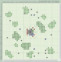
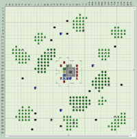
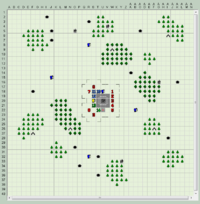
The experiment did use four maps.
|
Map 1 |
Map 2 |
Map 3 |
Map 4 |
Method
Organisation
Roles
Units
| ID | Type | Comment | |
| Fire Fighters |
Screen Pictures
Photos
Files
Experiment
| Player Instructions | |
| Configurations | |
| Video Recordings | |
| Logfiles |
Forest Fire
Water Logistic
Fuel Logistic
FireBreak
People
UAV
Map Symbols
Prediction
Art work
| Organisation | |
| Icones | |
| Pictures |


