Map Configuration
Maps
- This configuration is defined in main session config file: <config_name>.con
The map used in C3Fire should have the IDName = "Main"
The map is defined with the following basic properties:
  <Maps>

    <Map
      IDName = "Main"
      NameShort = "Main"
      NameLong = "Main"
      Type = ""
      AltitudeHigh = "0.0"
      AltitudeLow = "0.0"
      BackgroundColor = "#FFFFFF"
      BackgroundImage = "alt-1.gif"
      GridLineBoldColor = "#A0A0A0"
      GridLineThinColor = "#D0D0D0"
      GridType = "Square"
      GridUse = "false"
      IndexXType = "Alpha"
      IndexYType = "Numeric"
      InteractionDistanceBase = "50"
      LatitudeNorth = "0.0"
      LatitudeSouth = "0.0"
      LongitudeEast = "0.0"
      LongitudeWest = "0.0"
      MovingTime = "20"
      OSMFile = ""
      OSMNodeSize = "9"
      PosSize = "18"
      RoadColor = "#000000"
      RoadView = "False"
      ScrollBarUse = "False"
      Size = "40,40"
      Speed = "5.0"
      ViewDistanceBase = "70"
      ZeroCornerPos = ""
      ZoneFile = "Zones.xml" />


  </Maps>
|
Property |
Value |
|---|---|
|
IDName |
The map used in C3Fire should have the IDName = "Main" |
|
NameShort |
The map used in C3Fire should have the IDName = "Main" |
|
NameLong |
The map used in C3Fire should have the IDName = "Main" |
|
Type |
Value example= "" |
|
AltitudeHigh |
The maximum altitude height. |
|
AltitudeLow |
The minimum altitude height. |
|
BackgroundColor |
Value example= "#FFFFFF" |
|
BackgroundImage |
The image that should be displayed as background in the map. The pos default size are 18. Image size x (width) = (size.x * PosSize) + 1 Example Map size = "40,30" Value example = "MapImage.png" |
|
GridLineBoldColor |
The color of the thick matrix lines. Value example = "#555555" Value example= "#A0A0A0" |
|
GridLineThinColor |
The color of the thin matrix lines. The value should be a Hexa-Decimal based value as "#<Red><Green><Blue>" Value example = "#555555" |
|
GridType |
Value example= "Square" |
|
GridUse |
If a matrix showing squares on the map |
|
IndexXType |
The type of map index in the X direction (Left to Right). |
|
IndexYType |
Value example= "" |
|
InteractionDistanceBase |
Not working in C3Fire version 4.x Value example= "50" |
|
LatitudeNorth |
The map's latitude value at north. |
|
LatitudeSouth |
The map's latitude value at south. Value example= "0.0" |
|
LongitudeEast |
The map's longitude value at east. |
|
LongitudeWest |
The map's longitude value at west. |
|
MovingTime |
Value example= "20" |
|
OSMFile |
Value example= "" |
|
OSMNodeSize |
Value example= "9" |
|
PosSize |
The size of a map square. The size is the number of pixels in one square side. Possible value = "18" |
|
RoadColor |
The value should be a Hexa-Decimal based value as "#<Red><Green><Blue>" Value example Red = "#FF0000" Value example Yellow = "#FFFF00" |
|
RoadView |
Value example= "False" |
|
ScrollBarUse |
If the map should have scrollbars to support larger maps. |
|
Size |
The size of the map, the number of squares. Value example= "40,40" |
|
Speed |
Value example= "5.0" |
|
UseLayers |
Not working in C3Fire version 4.x Possible values = "True", "False" Module : MapLayers For more information about the module see MapLayers. This feature is possible only if Your C3Fire distribution has the module MapLayers included. |
|
ViewDistanceBase |
Not working in C3Fire version 4.x Value example= "70" |
|
ZeroCornerPos |
Where the map coordinate Zero corner should be. LeftTop : Numbers increases from top to bottom. |
|
ZoneFile |
Value example= "zones.xml" /> |
Map Position
- The map's position in the window is defined at, Map Position.
Map Objects
- See description at, Map Config Object.
Map Editor
- See description at, Map Editor.
Map with place names
- See description at, Map with place names.
Map Background Layers
This feature does not work in C3Fire version 4.x.
Defines the amount of layers for the Map, the image connected to the layer and the layers name on the quick select display. The location
of the MapPanel and the MapLayerQuickSelectDisplay on a clients user interface is configured in the clients user interface configuration.
Configuration example
<Source>
<MapLayer >

  <MapImageLayers>
    <MapImageLayer
      Name="Red"
      FileName = "vy-small-2035x1783.gif"/>
    <MapImageLayer
      Name="Blue"
      FileName = "road-2035x1783.gif"/>
    <MapImageLayer
      Name="Green"
      FileName = "green-2035x1783.gif"/>
    <MapImageLayer
      Name="White"
      FileName = "fly-2035x1783.gif"/>
  </MapImageLayers>

  <MapLayerQuickSelectDisplay>
    <MapLayerQuickSelect
      Name="Red" />
    <MapLayerQuickSelect
      Name="Blue" />
    <MapLayerQuickSelect
      Name="Green" />
    <MapLayerQuickSelect
      Name="White" />
  </MapLayerQuickSelectDisplay>

</MapLayer>
</Source>
MapImageLayers
Defines the amount of layers for the Map.
MapImageLayer
Defines the name of the layer and the image connected to the layer.
|
Property |
Value |
|---|---|
|
Name |
The name of the layer. Value example = "Blue","Green" |
|
FileName |
Name of the image that shall be visible at the layer. |
MapLayerQuickSelectDisplay
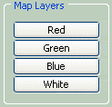
Defines the amount of buttons on the select map layer display.
MapLayerQuickSelect
Defines the name of the button connected to a MapImageLayer.
|
Property |
Value |
|---|---|
|
Name |
The name of the button representing a layer in the map. |
MapLayerQuickSelect
A button panel for selecting Map Layer.
|
Property |
Value |
|---|---|
|
Visible |
If the MapLayerQuickSelect panel should be visible. |
|
Pos |
The position of the MapLayerQuickSelect panel. Value example = "1140,505" |
|
Size |
The size of the MapLayerQuickSelect panel. Value example = "120,120" |
|
ButtonGridLayout |
The layout of the buttons in the panel Values example = "0,1" |
|
StartLayer |
The name of the map layer that is exposed when the session is started. Value example = "Green" |
<source>
 <Object
    Name = "MapLayerQuickSelect"
    Visible = "false"
    Pos = "1140,505"
    Size = "120,120"
    ButtonGridLayout = "0,1"
    StartLayer = "Green"/>
</source>


